How to get from Hong Kong city center to Hong Kong International Airport
There are three main ways for travelers to get from Hong Kong city center to the airport
- Taxi / Cab or Uber
I was staying in Causeway Bay, so a taxi from there to the airport would cost about $350-400, while Uber was over $400 when I checked. It seems to be a good choice if you are traveling with several people.
The time required from Causeway Bay is 33 minutes according to Google Maps. Some websites for travelers say it takes about 45 minutes. If it is a little crowded in the city, it is expected to take about that long. - MTR Airport Express
I used Airport Express the last time I visited Hong Kong, and it is a good option because all we have to do is to go to the station and you don’t have to worry about which one to take. It takes about 25 minutes from Hong Kong Station and costs only $110 with OCTOPUS, which is fast and reasonable. The MTR website has a detailed guide about the Airport Express, including fares and routes.
The time required from Causeway Bay seems about 40 minutes, which is from MTR Causeway Bay Station – Central Station (transfer) to Hong Kong Station – Airport.
One good thing is that if you use an Octopus card to transfer from MTR to Airport Express, the MTR fare is waived. The guide above mentions the following:
Passengers taking the Airport Express to interchange to MTR lines can enjoy free MTR connections. To benefit, use the same Octopus (with sufficient value) to interchange within one hour of arrival between the Airport Express at Hong Kong, Kowloon or Tsing Yi stations and the interconnecting MTR Line, including Lo Wu and Lok Ma Chau stations (except the Light Rail, MTR Bus and East Rail Line First Class). For passengers taking journeys starting with MTR lines followed by the Airport Express, the journey with the lower fare will be free. When changing between Tsim Sha Tsui/East Tsim Sha Tsui stations you must do so within 30 minutes of arrival at either station.
If there is an MTR station nearby and it is easy to get to Hong Kong Station, this may be a better option. - Citybus
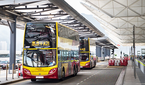
It’s an airport bus or a route bus operated by Citybus. This is the way I took this time, and it was surprisingly good. If there is an airport bus stop nearby, I recommend it because the price is cheap and you can enjoy the scenery from the second floor of the double-decker. It costs $41.90 from the bus stop at Causeway Bay. It took about 56 minutes from Causeway Bay to the airport when I actually got on the bus.
This time, I decided to take the bus to the airport . The reason was that I found out that there was a bus stop right next to the hotel where I was staying. Once we get on the bus, it stops at a bus stop on the way, but it’s the same as a taxi in that we’re just riding to the airport. If we sit on the second floor of the double-decker, the view would be better than in the taxi.
How to find Bus Route and Bus Stop
As for how to find a bus route and the nearest bus stop, I used the Citybus app (my smartphone is an Android). There is also a Citybus website, and it seems that you can also search for a bus route and bus stop.
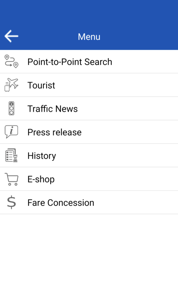
I opened the app, and tapped the three lines in the upper left to open the menu screen. There was Point-to-Point Search in the menu, so I tapped it.
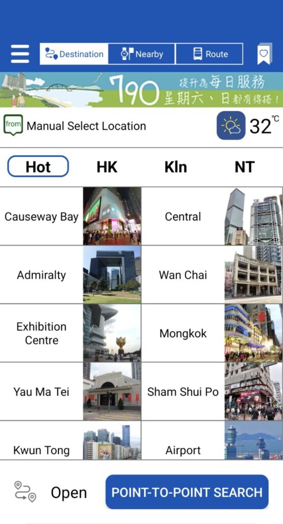
We need to enter the name of the place of the boarding point and the destination in the “from” and “to”.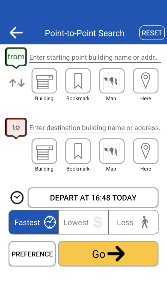
I entered “Causeway Bay” where I was now in “from”, and several options were displayed in a row. I selected “Area: Causeway Bay”.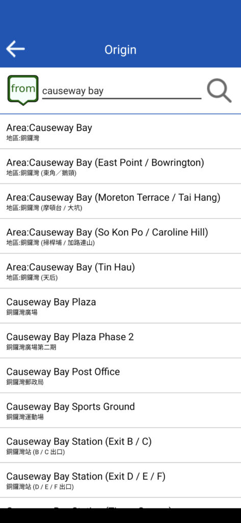
I entered “airport” in “to”, and several options were displayed in a row. I selected “Airport Passenger Terminal”.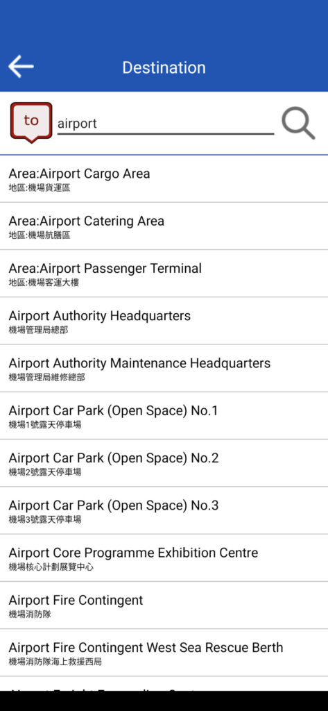
Area: Causeway Bay was set for “from”, and Airport Passenger Terminal was set for ”to”. I tapped “Go”.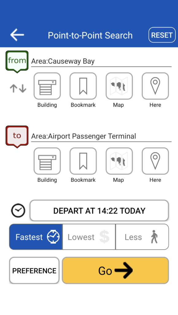
The route number of the bus was displayed. By route A11, the expected travel time was displayed as 70 minutes at this point. As described later, this is not the time we are on the bus, but the time from the current time to the estimated arrival time of the next bus that could be taken based on the current time. It is not as fast as a taxi because it stops at a bus stop on the way. The bus fare was also displayed and it was cheap at $41.9.
I tapped where it showed A11 on the screen above, and then I could see the name of the bus stop nearby where I could get on the bus, as shown in the screenshot below. The name of the bus stop was Cannon Street, Gloucester Road.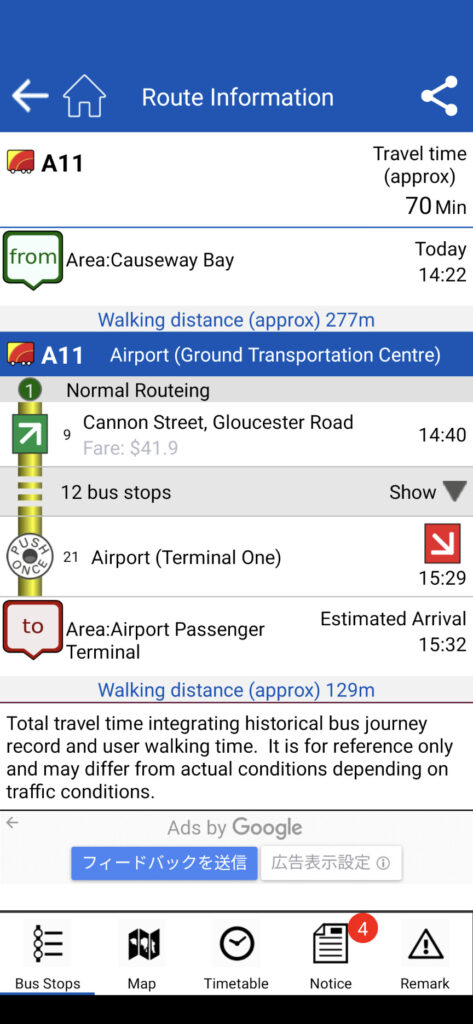
In this screen, I noticed that the 70 minutes mentioned earlier was not the time actually spent on the bus. Judging from this screen, it seemed to be the time from the current time to the estimated arrival time at the destination if I took the next available bus at that bus stop, based on the current time. The current time was 14:22, the next available bus from that bus stop would depart at 14:40, the estimated arrival time at the Airport (Terminal One) bus stop would be 15:29, and the arrival time at the Passenger Terminal would be 15:32 after walking from the bus stop to the Passenger Terminal. The 70-minute time period meant 70 minutes from 14:22 to 15:32. The actual time spent on the bus was assumed to be 49 minutes from 14:40 to 15:29.
Tapping the “Map” button at the bottom of the above screen, the A11 bus route from Causeway Bay to the airport was displayed on the map as shown in the following screenshot.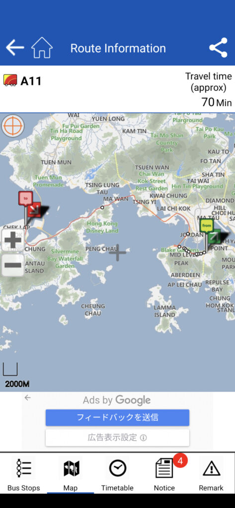
To check the location of the nearest bus stop, I pinched out with two fingers around the green “from” mark and zoomed in. The map was enlarged as the following screenshot. However, it was still not fully zoomed in, and I did not know where the nearest bus stop was.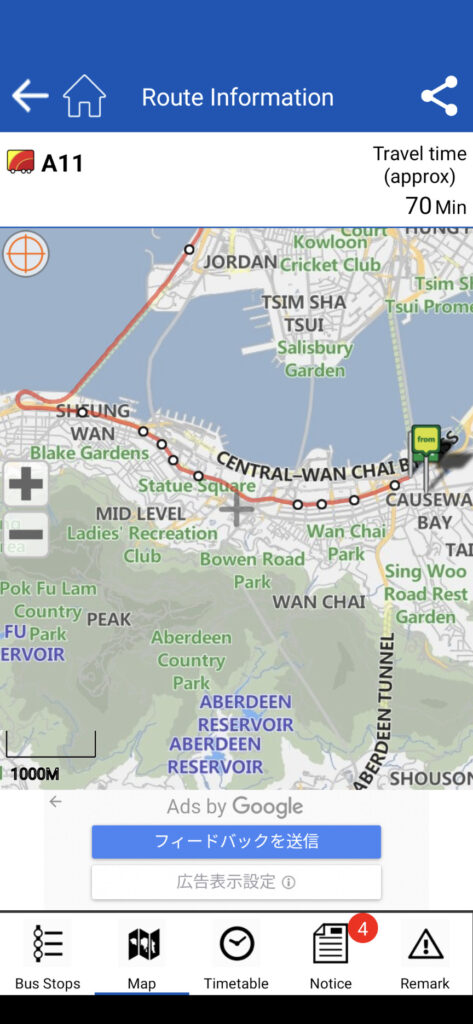
Furthermore, pinching out to zoom in on the map, I could see the location of the bus stop. A green-white arrow indicates a bus stop, and we can see that the bus stop is located there. The white dot on the route is the position of the next bus stop. A pin mark with “from” seems to indicate the typical point of the name of the place entered in “from” when searching.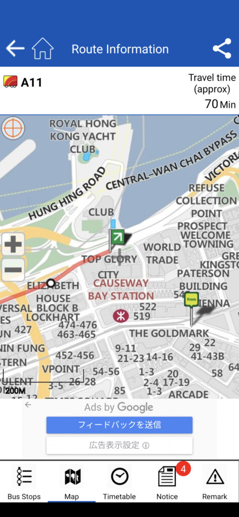
I found out that if I walked to this bus stop, I could take the 14:40 bus to the airport.
I was able to set the Park Lane Hotel where I was staying as “from”. When I typed “park lane”, “Park Lane Hotel” was displayed as an option. I tapped it to select it, and then searched for the route in the same way as above.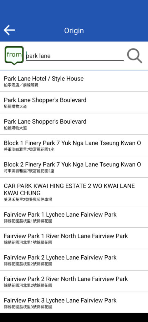
A11 was displayed and I found that the nearest bus stop was Kinston Steet, Gloucester Road.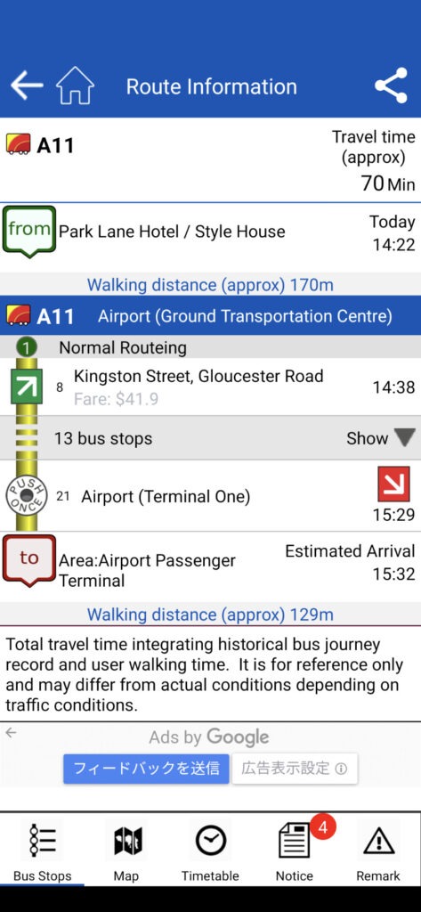
When I tapped Map and expanded the map to check the detailed location of this bus stop, I found that it was very close to the hotel. The green arrow was the bus stop, and the from pin was the location of the hotel I was staying at. It was best to get on the bus from this bus stop as it was just a short walk.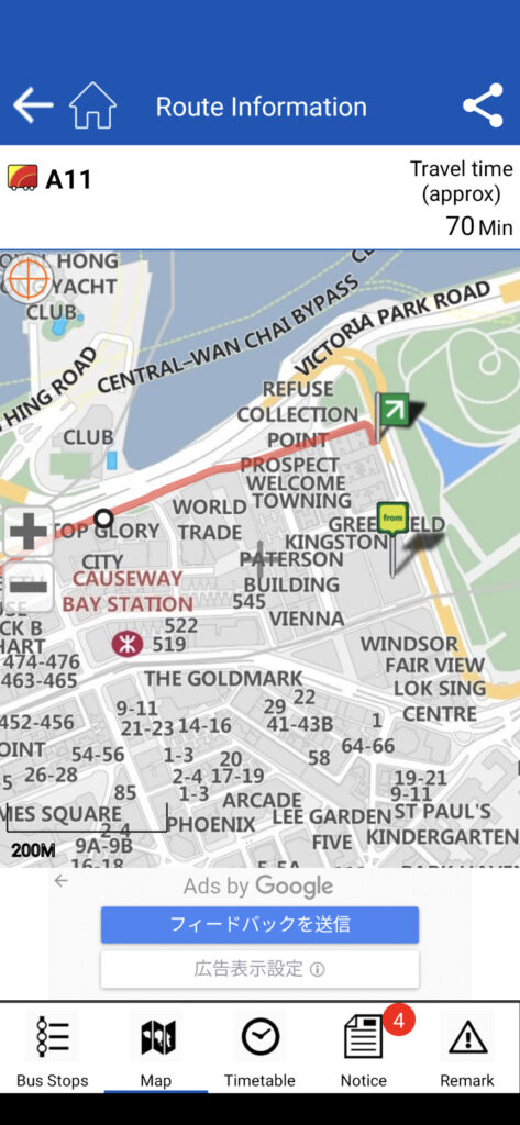
Some More Detailed Information about the Bus Coming to the Bus Stop
The app also shows the expected arrival time (or departure time) of the next bus coming to the bus stop, how far the bus is from the bus stop, and the time of the next bus after that and the next following bus. If there is not enough time for the next bus, we can refer to this information and make adjustments to get on the next bus after that.
If I tap the green-white arrow on the screen,
I can see the expected arrival time (or departure time) of the next bus at the bus stop, as well as the arrival time of the next after that and the next following bus, as shown in the screenshot below.
It also shows how many kilometers the next bus is to the bus stop. It shows that the next bus is 0.6km away from the bus stop at Kinston Steet, Gloucester Road. It is at 17:45 now, and the next bus will arrive at around 17:46. The next bus after that is at 18:03 and the next following bus is at 18:22. As for A11, it looks like the bus runs every 20 minutes at least during the daytime. (Please note that the screenshot below shows a different time period than the above screenshots because I took this screenshot at a different.)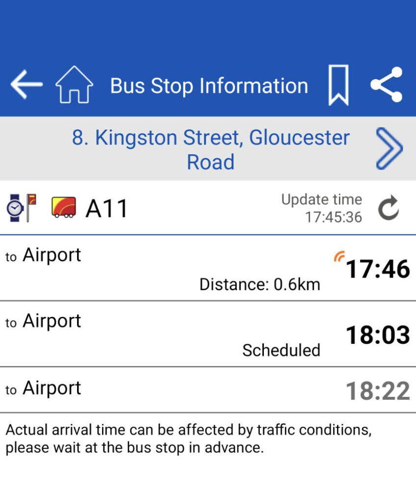
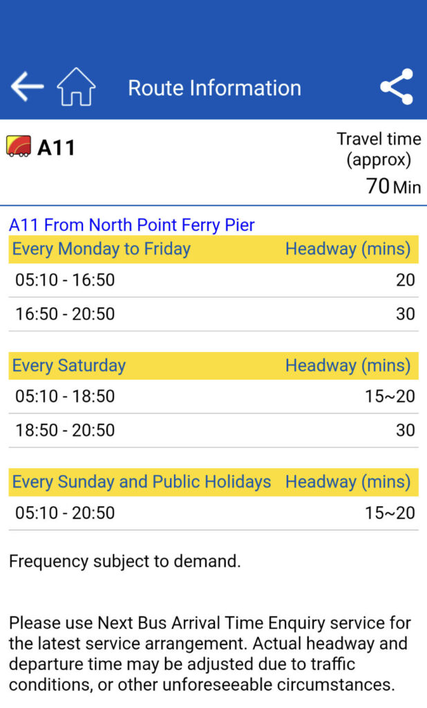
If we tap the Timetable at the bottom of the screen above, the below screen is to be displayed. A11 seems to be every 20 minutes during the daytime on weekdays and every 30 minutes in the evening and at night. It appears that there are more on Sundays with every 15-20 minutes.